Help us pin Brooklyn to the map!
If you know and love Brooklyn we need your help to get 300+ images from our collection pinned to Historypin’s map before their launch on July 11, 2011. If we don’t get cracking, Brooklyn is going to be woefully under-represented and that’s just not okay. Current Historypin totals have 1,358 images pinned to Manhattan with just 103 pinned to Brooklyn.
Brooklyn, we can do better than that!

Historypin launches July 11 with our without Brooklyn. Let's rally BK pride to make sure the borough is well represented!
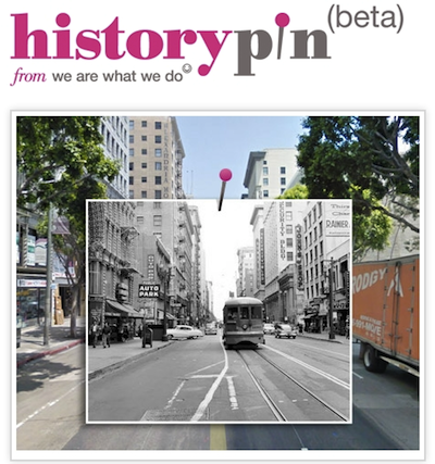
Historypin is a social sharing site meant to bridge the generation gap by encouraging its users to map historial images to modern day locations in order to show then and now comparisons and get people sharing more about history in the process. The site has been in beta for a year or so and we’ve been interested in participating, but we didn’t have enough hands around here to take some of our most interesting materials and get them onto the map because while they have been digitized, they’ve not been geotagged. That’s a major stumbling block and we need your help to get over this hump and ensure the borough of Brooklyn is well represented.
To get started we are going to begin a slow release of some amazing images of Brooklyn from the late 1800s to the Flickr Commons in the hopes that you can help us identify them and place them on a map.
In some cases, it will be very clear where these should be placed, but in others it will be a bit more of a mystery and require some sleuthing. Images that are geotagged by you will get placed on Historypin’s map for their launch on July 11 and we’ll be releasing more images every Tuesday and Thursday.
If you have a few minutes, help us out by mapping a few of these gems and you can continue to chart the project’s progress on our #mapBK leaderboard. Let’s represent!

Shelley Bernstein is the former Vice Director of Digital Engagement & Technology at the Brooklyn Museum where she spearheaded digital projects with public participation at their center. In the most recent example—ASK Brooklyn Museum—visitors ask questions using their mobile devices and experts answer in real time. She organized three award-winning projects—Click! A Crowd-Curated Exhibition, Split Second: Indian Paintings, GO: a community-curated open studio project—which enabled the public to participate in the exhibition process.
Shelley was named one of the 40 Under 40 in Crain's New York Business and her work on the Museum's digital strategy has been featured in the New York Times.
In 2016, Shelley joined the staff at the Barnes Foundation as the Deputy Director of Digital Initiatives and Chief Experience Officer.
